I post this with great sadness...Our cabin is in grave danger.
Southern CA not immune from fire, we all know this to be true. -The French fire (east of Bakersfield, near Lake Isabella) is burning within a couple of miles of my cabin . The address our cabin is at is under mandatory evac orders. This morning I was optimistic, as it appeared that the fire hadn't moved much in our direction, mainly because the wind was pushing it back on itself. That changed rapidly at about 11 AM today. Watching the timelapse from Shirley Peak, the wind stops around 11, the smoke stands straight up, and the fire races uphill. This peak is about 1 mile south of our cabin. I am now under no such optimism. It's up to the wind and the grace of God now.
Click on the link (below), then click on the "play" icon in the upper left, and choose the 12 hour timelapse.
Live webcams of the fire can be seen here:
http://www.alertwildfire.org/sierra/ind ... &v=7a7f1c2
Fascinting fire behavior can be seen by clicking the "play" icon in the upper left, and choosing a time lapse of :15, 1h, 3hr, 6hr, or 12 hr timelapse. Watch the 12 hour timeslapse before 11PM (Pacific) tonight- the speed is terrifying when the wind stops.
You can also scroll down for an alternate view- Shirley Peak2
I got some interesting screen grabs from those cams, but can't seem to get them to load.
REALTIME FLOWS  U. Kern: n/a cfs
L. Kern: 1341 cfs
E.W: 312 cfs
U. Owens: 108 cfs L. Owens: 496 cfs 09/02/19 1:15 PM PST
U. Kern: n/a cfs
L. Kern: 1341 cfs
E.W: 312 cfs
U. Owens: 108 cfs L. Owens: 496 cfs 09/02/19 1:15 PM PST


The End of an Era?
22 posts
• Page 1 of 2 • 1, 2
The End of an Era?
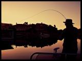
![]() by McFlyfi » August 20th, 2021, 4:20 pm
by McFlyfi » August 20th, 2021, 4:20 pm
-

McFlyfi - Posts: 123
- Joined: February 28th, 2009, 11:02 pm
Re: The End of an Era?
![]() by Gary C. » August 20th, 2021, 5:07 pm
by Gary C. » August 20th, 2021, 5:07 pm
I thought about your place as soon as I saw about the fire. A group I belong to has reservations in a couple weeks at Yenis Hante. Between the two I've been try to keep updated. I didn't where this tower/camera is at. It's not the one from the Alta Sierra ski lifts is it? Like you I mentioned, when I read that the evac order was changed to reach all the way to the 155 I still thought that Greenhorn would be pretty safe.
- Gary C.
- Posts: 1343
- Joined: September 15th, 2008, 2:18 pm
Re: The End of an Era?
![]() by Gary C. » August 20th, 2021, 5:39 pm
by Gary C. » August 20th, 2021, 5:39 pm
Sequoia National Forest is having a ZOOM Meeting today at 6:30 pm
- Gary C.
- Posts: 1343
- Joined: September 15th, 2008, 2:18 pm
Re: The End of an Era?
![]() by Wildman » August 22nd, 2021, 4:33 pm
by Wildman » August 22nd, 2021, 4:33 pm
I have been there many times-often while I was assigned to the fire threatening our village and other times hundreds of miles away on fire assignment. I wish you the best and hope things will be the same when the smoke clears.
"Tomorrow is the most important thing in life. Comes into us at midnight very clean. It's perfect when it arrives and it puts itself in our hands. It hopes we've learnt something from yesterday."
John Wayne
John Wayne
-

Wildman - Site Admin
- Posts: 3747
- Joined: August 17th, 2008, 2:07 pm
Re: The End of an Era?
![]() by Jimbo Roberts » August 22nd, 2021, 9:46 pm
by Jimbo Roberts » August 22nd, 2021, 9:46 pm
Just saying "Good Luck" doesn't quite cover it.
I've seen mountain homes burn before, and there is that helpless feeling when you know, nothing is going to keep it from burning and all you can do is turn your back on it and get out with what you can carry.
Still,.. wishing you all the best luck can offer.....
Jimbo
I've seen mountain homes burn before, and there is that helpless feeling when you know, nothing is going to keep it from burning and all you can do is turn your back on it and get out with what you can carry.
Still,.. wishing you all the best luck can offer.....
Jimbo
- Jimbo Roberts
- Posts: 1329
- Joined: October 19th, 2011, 7:47 pm
- Location: San Antonio Texas
Re: The End of an Era?
![]() by WanderingBlues » August 23rd, 2021, 6:07 am
by WanderingBlues » August 23rd, 2021, 6:07 am
Hoping for some good news for you.
"We're a cross between our parents and hippies in a tent...."
180 Degrees South
180 Degrees South
-
WanderingBlues - Posts: 5299
- Joined: December 2nd, 2009, 10:49 am
- Location: Living in a Tin Can
Re: The End of an Era?
![]() by mtnguru » August 23rd, 2021, 10:03 am
by mtnguru » August 23rd, 2021, 10:03 am
If you haven't already done so, the fire maps are updated daily and uploaded to the ftp.wildfire.gov site.
Spying on the E size Operations map can give you a pretty good ballpark of current fire perimeter. There are also heat signature (IR) maps that show current intensity and such.
Below is a link to the French Fire's exclusive maps. If you feel comfortable, PM me your address and I might be able to navigate the maps a little easier and help you out when I have some time. I also have a strike team of engines from my unit that are assigned to that fire. I don't know that I have any buddies on any of them but I'll check and see if I do and if they have any intel I can pass along.
https://ftp.wildfire.gov/public/incident_specific_data/calif_s/!2021_Incidents/CA-CND-002796_French/GIS/PRODUCTS/
Unfortunately, I've been assigned to the Dixie fire for the past month, with one more week to go before I have some time off for our Yellowstone trip. If I can help, let me know. If you need help navigating the FTP site, ask away and I'll try to help where I can.
-

mtnguru - Posts: 305
- Joined: September 12th, 2008, 1:06 pm
- Location: San Diego
Re: The End of an Era?
![]() by McFlyfi » August 23rd, 2021, 10:11 am
by McFlyfi » August 23rd, 2021, 10:11 am
So far...So good. In my opinion, the big night was Saturday. We had a feeling hat if they could stop the progress from where it kinda stalled at Shirley Peak on Friday, that we would have a chance. Saturday night was a nervous one, but Sunday morning showed nearly no progress towards us. Monday morning is showing the same.
We've had reports from neighbors who have stayed behind about the structure protection people in place, and that is encouraging. There have been spot fires within the community that have been addressed immediately with hand crews and water drops.
I have attached the pictures I grabbed from the cameras.
Gary- These cameras are in Shirley Peak, but these are not the resort cameras. There is a tower on top of the peak with all kinds of comm equipment- cameras, cell repeaters, etc.
These images were all taken on Thursday. By the next day, all of the forest in the foreground had ben burnt, and the fire was at the base of the tower.
- Tank.jpg (53.92 KiB) Viewed 3940 times
- Attachments
-
- Pilot.jpg (42.04 KiB) Viewed 3939 times
-
- Pink.jpg (41.28 KiB) Viewed 3940 times
-
- Pink.jpg (41.28 KiB) Viewed 3940 times
-
McFlyfi - Posts: 123
- Joined: February 28th, 2009, 11:02 pm
Re: The End of an Era?
![]() by McFlyfi » August 23rd, 2021, 10:17 am
by McFlyfi » August 23rd, 2021, 10:17 am
Fire image, below tower.
- Fire.jpg (70.9 KiB) Viewed 3937 times
-
McFlyfi - Posts: 123
- Joined: February 28th, 2009, 11:02 pm
Re: The End of an Era?
![]() by McFlyfi » August 23rd, 2021, 11:09 am
by McFlyfi » August 23rd, 2021, 11:09 am
mtnguru wrote:If you haven't already done so, the fire maps are updated daily and uploaded to the ftp.wildfire.gov site.
Spying on the E size Operations map can give you a pretty good ballpark of current fire perimeter. There are also heat signature (IR) maps that show current intensity and such.
Below is a link to the French Fire's exclusive maps. If you feel comfortable, PM me your address and I might be able to navigate the maps a little easier and help you out when I have some time. I also have a strike team of engines from my unit that are assigned to that fire. I don't know that I have any buddies on any of them but I'll check and see if I do and if they have any intel I can pass along.
https://ftp.wildfire.gov/public/incident_specific_data/calif_s/!2021_Incidents/CA-CND-002796_French/GIS/PRODUCTS/
Unfortunately, I've been assigned to the Dixie fire for the past month, with one more week to go before I have some time off for our Yellowstone trip. If I can help, let me know. If you need help navigating the FTP site, ask away and I'll try to help where I can.
Thank you very much for this,I appreciate the info.
I personally have a pretty fatalistic view of this. I hate the trope, but it is what is is. On Friday, I was pretty sure that the whole community would be gone by daylight on Saturday. But with the weather/wind holding for a couple of days, I do now have a bit of hope that the hard work by the firefighters up there have done some good. I got a text from Karen who had an update this morning that they are bringing in a Chinook CH-47, a big twin rotor helo for big water drops.
It's not just our little community at risk either- all of Wofford Heights (that whole west side of Isabella Lake) that is under siege. A lot of people down there with no other place to go...For us, it's a real "first world" problem...
-
McFlyfi - Posts: 123
- Joined: February 28th, 2009, 11:02 pm
Re: The End of an Era?
![]() by rayfound » August 23rd, 2021, 2:41 pm
by rayfound » August 23rd, 2021, 2:41 pm
Man, these last few years have been exceptionally challenging. Here's hoping your community makes it out okay.
Fishing is the most wonderful thing I do in my life, barring some equally delightful unmentionables.
http://www.adiposefin.com
http://www.adiposefin.com
-

rayfound - Posts: 2400
- Joined: September 11th, 2008, 11:11 pm
- Location: Riverside, ca
Re: The End of an Era?
![]() by Ants » August 23rd, 2021, 6:09 pm
by Ants » August 23rd, 2021, 6:09 pm
That is a difficult area to protect, but the efforts seems to be successful so far. The owner of the local grill,posted on twitter that no homes were lost to date.
Here’s hoping the efforts stay successful.
Ants
PS. I believe the webcams were at a little south of the ski area.
Here’s hoping the efforts stay successful.
Ants
PS. I believe the webcams were at a little south of the ski area.
- Ants
- Posts: 716
- Joined: May 2nd, 2013, 7:04 pm
Re: The End of an Era?
![]() by McFlyfi » August 25th, 2021, 8:28 am
by McFlyfi » August 25th, 2021, 8:28 am
It's been a rough few days. After the initial run from the 18th-20th, the fire has mad a relatively slow crawl towards Alta Sierra. There are some reports of structure loss in Alta Sierra. Based on this mornings fire map, I can pretty safely say that it is only a matter of time. I do hold out some small hope that fire crews on hand can protect the eastern and southern flanks. The more imminent danger now is Wofford Heights and even Kernville after a huge run yesterday/last night.
https://kcfd.maps.arcgis.com/apps/insta ... 255fc88417
If you scroll in on the little pocket that is Alta Sierra, zoom in on the eastern side, look for Spruce Drive. Our cabin is on Spruce, about halfway between where Juniper splits off and rejoins at Fir on the east side. If the map is accurate, the fire is now about 100 yards from us. I would now say that it is more likely than not that it is no more.
As Tom Petty said:
"The waiting is the hardest part..."
-
McFlyfi - Posts: 123
- Joined: February 28th, 2009, 11:02 pm
Re: The End of an Era?
![]() by Papasequoia » August 26th, 2021, 9:36 am
by Papasequoia » August 26th, 2021, 9:36 am
Thanks for the update and I continue to hope for the best for all.
Nature always wins.
> miles = < people
Camp in the mountains, not the left lane!

> miles = < people
Camp in the mountains, not the left lane!
-
Papasequoia - Posts: 4655
- Joined: July 5th, 2008, 10:14 pm
- Location: East Side of the Sierra Nevada
22 posts
• Page 1 of 2 • 1, 2
Who is online
Users browsing this forum: No registered users and 151 guests