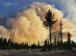
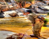
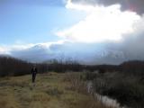
Wow, it looks like there is another fire, this one may have taken out the Big Springs campground. Just like the fire in August, only this time right where I was camped. I heard some cabins on the Alpers Ranch burned as well.
Fire and Drought, what a mess.
John
REALTIME FLOWS  U. Kern: n/a cfs
 L. Kern: 1341 cfs
 E.W: 312 cfs
 U. Owens: 108 cfs
  L. Owens: 496 cfs 09/02/19 1:15 PM PST
Fire in Big Springs/Alpers Ranch area!
12 posts
• Page 1 of 1
Re: Fire in Big Springs/Alpers Ranch area!
Human caused fire....Why am I not surprised?

6,000 acres +
Here is the Inciweb page. Check out the pictures. Remember much of this is simply Sage and Manznitia and it's really burning well/
http://inciweb.nwcg.gov/incident/5034/

6,000 acres +
Here is the Inciweb page. Check out the pictures. Remember much of this is simply Sage and Manznitia and it's really burning well/
http://inciweb.nwcg.gov/incident/5034/
"Tomorrow is the most important thing in life. Comes into us at midnight very clean. It's perfect when it arrives and it puts itself in our hands. It hopes we've learnt something from yesterday."
John Wayne
John Wayne
-

Wildman - Site Admin
- Posts: 3747
- Joined: August 17th, 2008, 2:07 pm
Re: Fire in Big Springs/Alpers Ranch area!
Saw the cloud from that Sat. afternoon heading out for a hike but it looked far enough away not to worry. Driving back down out of the lakes basin late in the day it was much more noticeable and looked a lot closer. Checked the web it was at 500 acres, then the next morning at 1,500 and it was closer than I thought (almost drove south Saturday night just in case). Bummer about the Alpers' cabins - hopefully it will burn up some more old fuel without affecting any of the other ranches in the area while they get it under control.
Nature always wins.
> miles = < people
Camp in the mountains, not the left lane!

> miles = < people
Camp in the mountains, not the left lane!

-

Papasequoia - Posts: 4655
- Joined: July 5th, 2008, 10:14 pm
- Location: East Side of the Sierra Nevada
Re: Fire in Big Springs/Alpers Ranch area!
Was thinking of big springs for this weekend as well.
jon
jon

2013: Days on the Water so far - 29
2014: Days on the Water so far - 28
-

stanbery - Posts: 4410
- Joined: July 26th, 2008, 2:00 am
- Location: Palmdale CA
Re: Fire in Big Springs/Alpers Ranch area!
stanbery wrote:Was thinking of big springs for this weekend as well.
jon
Probably not an option for a while
"Tomorrow is the most important thing in life. Comes into us at midnight very clean. It's perfect when it arrives and it puts itself in our hands. It hopes we've learnt something from yesterday."
John Wayne
John Wayne
-

Wildman - Site Admin
- Posts: 3747
- Joined: August 17th, 2008, 2:07 pm
Re: Fire in Big Springs/Alpers Ranch area!
Wildman wrote:stanbery wrote:Was thinking of big springs for this weekend as well.
jon
Probably not an option for a while
Nope
See you Thursday
Jon

2013: Days on the Water so far - 29
2014: Days on the Water so far - 28
-

stanbery - Posts: 4410
- Joined: July 26th, 2008, 2:00 am
- Location: Palmdale CA
Fire in Big Springs/Alpers Ranch area!
stanbery wrote:Was thinking of big springs for this weekend as well.
jon
I was also thinking of going there, that is a very delicate fishery. I hope the fire does not destroy it.
Sent from my iPhone using Tapatalk
Rasputinj
- Rasputinj
- Posts: 543
- Joined: October 8th, 2011, 9:06 pm
Re: Fire in Big Springs/Alpers Ranch area!
I was up in the area 9/25 - 10/3 (report soon)
When I drove by on 9/26 the Owens River Rd was still closed.
Next time through was 9/30 - the ORR was open, but USFS was manning (actually, womaning) the entrance to Big Springs. I asked if I could walk in for some pictures and got told "inopportune time because of end-of-day activities taking place". Apparently they still had USFS fire control people still in there working mop-ups, and the campground was being used as a command/staging area for their activities.
The fire perimeter map on http://www.geomac.gov ("Launch Viewer") seem to be pretty accurate - Big Springs is approximately the SW corner of the burn area; approaching there from the west (395) there is no fire evidence N/S apparent from the Owens River Road. (e.g. Deadman Creek)

But starting immediately on the east side of Big Springs forest road, the Owens River Rd is indeed the fire perimeter; the tree line is burned right to the road, and there is nothing left in terms of ground cover under the burned canopy. Apparently the firefighters were able to "hold the line" at the River Road towards the east for about 1 mile.
I drove down the Owens River Road till about the Alpers Ranch - it was late, so the pics aren't great.
Alpers Ranch Entrance

The fire jumped the Owens River Road to the south right at this location.

Yesterday - 10/3 - I drove a little further along the Owens River Road
Western Gate of Arcularius Ranch

It would appear that a heroic effort was made with respect to structure protection in the vicinity of buildings at Arcularius; literally the immediate vicinity of buildings was saved, but is completely surrounded by 100% burn in a 360 degree circle.

This picture of the stockyard area just to the east of Arcularius shows the huge area to the North that burned (if you zoom in you'll see that ranch house (rental?) was also saved. Unfortunately, I surmise this whole are drains to the Owens.


At Big Springs, the USFS still had a closure at the entrance, but nobody was there so I walked in as far as the Owens River crossing and shot some pictures.
These shots were taken standing on the road crossing at the culvert that the Owens runs through
View to the NE

Down-River

South Bank of River

I didn't want to press my luck hiking down-river; so I'm not sure if this little green area reveals much about the burn right in the riverbed area for the mile of (public) water downstream from here to the (Alper's) fenceline; I can tell you though that the forest is completely nuked at the Owens River Road along this stretch.
I walked through that burned wooded area on the way back to my truck. The forest floor is covered in flour-like ash to a depth of about 2 inches.
I suppose that if there is any good news in any of this, at least the spawning areas between the culvert and the springs won't see increased sediment loading from fire ash; but it's a long gauntlet for any fish that try to make it upstream from Crowley. (I saw some of those fish pre-season this year; they were enormous).
[Edit] PS I should add that I talked to a FS employee (at a different location); despite the fact that the campground area was not damaged, it will remain closed for the rest of the season. (It's close to the end of it's normal season anyway).
When I drove by on 9/26 the Owens River Rd was still closed.
Next time through was 9/30 - the ORR was open, but USFS was manning (actually, womaning) the entrance to Big Springs. I asked if I could walk in for some pictures and got told "inopportune time because of end-of-day activities taking place". Apparently they still had USFS fire control people still in there working mop-ups, and the campground was being used as a command/staging area for their activities.
The fire perimeter map on http://www.geomac.gov ("Launch Viewer") seem to be pretty accurate - Big Springs is approximately the SW corner of the burn area; approaching there from the west (395) there is no fire evidence N/S apparent from the Owens River Road. (e.g. Deadman Creek)

But starting immediately on the east side of Big Springs forest road, the Owens River Rd is indeed the fire perimeter; the tree line is burned right to the road, and there is nothing left in terms of ground cover under the burned canopy. Apparently the firefighters were able to "hold the line" at the River Road towards the east for about 1 mile.
I drove down the Owens River Road till about the Alpers Ranch - it was late, so the pics aren't great.
Alpers Ranch Entrance

The fire jumped the Owens River Road to the south right at this location.

Yesterday - 10/3 - I drove a little further along the Owens River Road
Western Gate of Arcularius Ranch

It would appear that a heroic effort was made with respect to structure protection in the vicinity of buildings at Arcularius; literally the immediate vicinity of buildings was saved, but is completely surrounded by 100% burn in a 360 degree circle.

This picture of the stockyard area just to the east of Arcularius shows the huge area to the North that burned (if you zoom in you'll see that ranch house (rental?) was also saved. Unfortunately, I surmise this whole are drains to the Owens.


At Big Springs, the USFS still had a closure at the entrance, but nobody was there so I walked in as far as the Owens River crossing and shot some pictures.
These shots were taken standing on the road crossing at the culvert that the Owens runs through
View to the NE

Down-River

South Bank of River

I didn't want to press my luck hiking down-river; so I'm not sure if this little green area reveals much about the burn right in the riverbed area for the mile of (public) water downstream from here to the (Alper's) fenceline; I can tell you though that the forest is completely nuked at the Owens River Road along this stretch.
I walked through that burned wooded area on the way back to my truck. The forest floor is covered in flour-like ash to a depth of about 2 inches.
I suppose that if there is any good news in any of this, at least the spawning areas between the culvert and the springs won't see increased sediment loading from fire ash; but it's a long gauntlet for any fish that try to make it upstream from Crowley. (I saw some of those fish pre-season this year; they were enormous).
[Edit] PS I should add that I talked to a FS employee (at a different location); despite the fact that the campground area was not damaged, it will remain closed for the rest of the season. (It's close to the end of it's normal season anyway).
- Tim P
- Posts: 9
- Joined: September 18th, 2011, 8:13 am
Re: Fire in Big Springs/Alpers Ranch area!
Thanks for giving us the scope of the fire damage. Very glad that they could save the Arc. buildings, even though I'll never see the inside of them ever again. No more coverage for my fantasy, poaching trip left standing but, I'm sure it'll be renewing itself next spring.
BOb
BOb
"He told us about Christ's disciples being fishermen, and we were left to assume, as my brother and I did, that all first-class fishermen on the Sea of Galilee were fly fishermen and that John, the favorite, was a dry-fly fisherman."
-

Baughb - Posts: 180
- Joined: March 16th, 2011, 5:18 pm
- Location: Burbank, CA.
Re: Fire in Big Springs/Alpers Ranch area!
Thanks for posting the pictures. I've been hoping to see some.
- Gary C.
- Posts: 1343
- Joined: September 15th, 2008, 2:18 pm
Re: Fire in Big Springs/Alpers Ranch area!
Thanks for the update report and pics.
Nature always wins.
> miles = < people
Camp in the mountains, not the left lane!

> miles = < people
Camp in the mountains, not the left lane!

-

Papasequoia - Posts: 4655
- Joined: July 5th, 2008, 10:14 pm
- Location: East Side of the Sierra Nevada
Re: Fire in Big Springs/Alpers Ranch area!
Wow - great shots / report. Thanks for this. Sad to see the burn - maybe for the best long term though?
Fish always lose by being "got in and dressed." It is best to weigh them while they are in the water. The only really large one I ever caught got away with my leader when I first struck him. He weighed ten pounds. —Charles Dudley Warner
-

silverlaker - Posts: 726
- Joined: April 4th, 2011, 10:14 pm
- Location: los angeles

